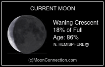
Monday, September 6, 2010

August 26 Kayak Chamber's Island

Paddle to Chambers Island, by Moonlight

Launched from the Tennison Bay Kayak Launch about 6 PM
Landed on Chambers about 7:15
Left Chambers 7:25
Arrived back at the put in at 9 PM

Launch in Tennison Bay
Nice paddle…wind started out light from the SW and built into the mid-teens from the S with 2.5+ waves, before I reached Chambers.   I hurried getting a snack and drink as I wanted to get headed back so I would be through the larger waves before it became dark. 

On the beach at Chambers
The sun was going to set in about 20 minutes so I left. The wind was still building up into the high teens aand the wave were pushing 3 feet just before I reached Adventure Island. They gradually calmed down as I closed the distance to Adventure Island and reached its lee shore.  The rest of the paddle was more sheltered by the Islands and mainland so the waves gradually calmed .
Shortly after I left Adventure Island the moon rose just about where the landing should be, but as I got closer to shore it was actually blinding me from seeing the shoreline until I was close enough so the trees blocked it out.  Of course in the dark, finding the landing was difficult…I was counting on someone to sit on the ramp and watch the stars…if they bring kids, there are always flashlights. The couple there didn’t have any kids, but the dude was smoking a cigarette, and I saw the glow. I yelled to them if that was the boat ramp, yes came the reply and I yelled back that I thought you were going to built a bonfire so I could find my way back…they chuckled and he offered to help carry the boat up.

The trip was about 11 miles as I wandered a bit to be in the shelter of the Islands on the way back.

I had a light on, kept eyes and ears sharp for boats...saw none.   Had a radio, flares, strobe and cell.
I enjoy paddling or sailing in the dark...usually little to no boat traffic and basically a different world

August 21, Kayak, Fish Creek, WI

This evening I went to Fish Creek. My daughter was curating a showing of new artists at the Peninsula Art School. I visited for a while, had a few snacks, and chatted with some folks. Stayed about an hour. I was dressed for the showing, but just so happened to have my paddling gear in the truck. Since I had not paddled in Fish Creek Harbor, this seemed like a good opportunity. Launched at Nelson’s Point about 7 pm, near the picnic area and paddled into town.

A small Drascombe boat anchored behind the breakwater of Weber’s Point caught my eye. The light was good, a low sun with the moon rising behind the traditional looking lap strake boat…nice. Then headed across the harbor and just cruised around.
The Steel Schooner "Friendly"

There were a couple steel ketches about 40 feet, a 38 foot wooden Ketch and a steel schooner. I didn’t realize there were so many small cottages with dock space along the water…It would be a nice place to stay for a week if you had a large or small boat (kayak)... So I followed the shoreline North, it was getting dark by the time I found Fish Creek and followed it up stream a ½ mile or so to “Not Licked Yet” a good ice cream/sandwich place. It was dark by then, but I took a few flash photos of patrons taking photos of the kayaker in the dark.

Up Fish Creek at "Not Licked Yet"
As I went back down the creek, 4 deer jumped across not more than 15 feet ahead of me, gee that would have been exciting if they had run me over...in a kayak. So the paddle back was in the dark, with a 3/4 moon. Had a little trouble making out the landing as it was just a path down to the water form the picnic area, with really not much of a landmark... After loading the car, I called Mag on the cell to see if she was still in town. She was, so we met up at Malabo Moos for a couple cones on the way home.

August 18, Kayak Sawyer Harbor

We launched in Potawatomi State Park about 5:30 at the
Park's boat ramp.
Light Winds, Partly Cloudy,
the water temperature was in the mid-60’s
Laurel, Tim, DD, Terrie, and I showed up.
Lost Creek
Headed over to the mouth of Lost Creek following the winding shoreline and found it pretty much choked with weeds, but I cut a path up the creek to the first old dock and turned around. Saw an ugly snapper, covered with moss and weeds peering up at me as he grabbed some air.

Lower end of Sawyer Harbor
We headed over to the mouth of Sawyer Harbor and around Cabot’s Point toward the Sherwood Point Lighthouse…one of the last manned lighthouses on the Great Lakes.
Heading Toward the Light
Sherwood Point Light
Now it is used as rental for military who need a little R & R.
Sherwood Point Light
A few small waves, but the water was mainly flat.
We rounded Sherwood Point passed the picturesque light house and headed at a leisurely pace back to Sawyer Harbor and the launch, enjoying the warm sunset as we pulled out.


Watching the Sun go Down
South of Sherwood Point
Inside Sawyer Harbor

The launching area at Potowatomie
We traveled about 10 miles.
The next few photos are from a trip I took to Saint Martin a few years ago.
It was nice to see Terrie during this paddle, so we got caught up on where we have been and she had just been to St Martin Island...with Laurel, Tim and some others.
They spent couple days on Rock Island, which my daughter and I visited last month, and a few on St Martin, exploring the islands with feet and paddle.

St Martin is private and about 5 miles N of Rock Island State Park.
It is pretty much out there subject to weather...20 miles to the west is Michigan, 15 miles to the North is Fairport, Michigan and 70 miles or so to the East is the other side of Lake Michigan. It experiences alot of severe, variable weather.  Each time I have visited, I was windbound by 25+ winds for an extra day.
St Martin Island
An old map of a previous trip to St Martin

St Martin Island Lighthouse

 
Poverty Island Light
They managed to take a side trip over to Poverty Island, which is an island 5 miles North of St Martin.

Cold fronts are coming through now, with the daytime highs in the mid-70’s and in the 50’s at night…summer is leaving and fall is creeping in…the warmth of summer is barely long enough to burn off the chill memories of our long winter…sometimes as a friend tells me, ya just want to walk south carrying a snow shovel until someone asks what it is, then you know it is warm.

Saturday, August 21, 2010

August 16th, Kayak...chasing Europa...Sturgeon Bay

The Europa

Sometime today, I suspected the Tall Ships would be coming through town on their way down Lake Michigan to Chicago and other ports. Several are involved in a race starting Tuesday morning off the eastern entrance to the canal…racing down to Chicago

http://www.sailtraining.org/tallships/2010greatlakes/index.php

I had asked my kayak buddies to keep an eye out for the boats and several either e-mailed or called my cell to let me know ship locations. Some were at the city dock after work, so I hung out there taking some photos, then went to the boat launch in Sunset Park as I could get a good look North into Green Bay…and here was the Europa, under full Sail…I ran home changed into some paddling clothes came back and launched just as she sailed by about a ½ mile away.


So I started following, taking pictures along the way. The problem with picture taking when you are trying to overcome a ship that is traveling at close to your hull speed is I would lose several hundred feet every time I stopped. Finally I was right up on her stern after several miles, got some close-ups, then peeled away to check out the seven other boats now docked around town. The “Friends Good Will”, “Royalist”, “Dennis Sullivan”, “Niagara”, “Lynx”, “Pride of Baltimore II”, “Unicorn” and the “Roseway”.
The Royalist


Safety net under the bow sprit of the Niagra

Information about the ships; http://www.sailtraining.org/tallships/2010greatlakes/participatingvessels.php

Where are they now? Going to Chicago.

Check on their progress here; http://www.sailwx.info/shiptrack/tsc2010.phtml

Bear in mind that some of the data is several days behind.

August 14th, Tall Ships in Green Bay, WI

Saturday I went to Green Bay with Jeff to board the ships of the Great Lakes Challenge Fleet.

The first was the Bounty…a replica built in Lunenburg during the early 60’s for the movie “Mutiny on the Bounty”. At the end of the movie when the mutineers reach Pitcairn Island they burn the ship and this Bounty was to be burned, but Marlon Brando convinced them to use a model instead…and so here we are, lucky to be walking her deck 50 years later. We picked ships to board by the length of the waiting line.

The Brig Niagara was next. In 2006 she offered instructional rides to 30 or 40 people from Green Bay to Sturgeon Bay and I was lucky enough to be one.

Tall Ships in NE WI

By the time we were off the Niagara, the line to the Bounty had grown to several hundred feet. We boarded the Pride of Baltimore II…a replica of a topsail schooner that was used as a Privateer…a sleek looking ship. It was 1 pm and we had been here since 9...time to go.
Pride of Baltimore, anchored in Sturgeon Bay...2006

I had considered kayaking in the Fox River to look at the ships, but there were many people with boats doing the same. I'd rather have more seclusion

August 12th, Sturgeon Bay Ship Canal

Tall Ship parade captured by Jeff

12 of the Great Lakes Challenge ships gathered off the entrance to the Sturgeon Bay Ship Canal, for a “parade” through Sturgeon Bay. Jeff was able to get some awesome photos of the ships backlit by the morning sun while appearing out of a dense fog.
They are headed for a rendezvous in the city of Green Bay

The Bounty
Pride of Baltimore II has arrived

August 11th, Portage Park, Door County, Kayak, Tall Ships visiting

The Bounty was anchored off Portage Park

Bounty and the Roald Amundsen
I knew the ships were sailing through town on Thursday and suspected some would arrive early and overnight in the area. I drove out to the break wall on the North side of the Sturgeon Bay Coast Guard station to scan Lake Michigan for sails. One was visible way to the North under sail and another was anchored a mile or two to the North…Portage Park. OK, as I headed home to pick up a camera and paddling gear I called my buddy Jeff and he came out to the breakwater. I went back to Portage Park.


Bounty Anchored off Portage Park, Door County, WI

While I was getting ready, a guy pulled up and started asking me about what I was doing and why I was wearing all that stuff …gee a pair of dry pants and a spray top, spray skirt…he said the water was warm, why are you wearing all that gear?.., I never wear anything while fishing…so I tried to explain, why I try to wear “clothes” while paddling, even when the water is a balmy 65 degrees. He gave me the impression that weaqring more than a swim suit was a little much.


So I launched and paddled the mile or so out to where the Bounty was anchored. Winds were light, waves less than 2 feet, overcast, the water was in the 60’s. Took some photos of the ship, spoke with one of the crew…they had come from Soo Saint Marie, MI. Told him I had been out to Lunenburg where the Bounty was constructed.

I’m thinking to myself…little did I ever imagine…one day I would paddle a kayak off into Lake Michigan to practically touch a wooden ship I had seen in a move 40 years before…or that I had been to the town where she was built…

On the way home Jeff and I stopped at the town dock to observe the ships staying overnight there
The Schooner Roseway

August 10, Paddled to Hat Island

Parked at the end of Juddville Road a few miles North of Egg Harbor.
Light SW winds water warm…air 80.

It is a straight line paddle…three miles out, around the island, three miles back. The Island is nothing more than a gravel pile, used by the bird community to hatch and raise young and by bird hunters in the fall to take a few duck and geese.

There are the remnants of some old structures on the island, probably pre 1920’s and some modern amenities such as a boat lift, a crude boat railway and some blinds used by the hunters.

Many white pelicans, herring gulls, some common terns and cormorants.

I did see a young pelican…wasn’t able to fly yet, but it was in the water swimming.

August 10, 2010
July 12, 2006
In 2006 Laurel, Rich and I went out there on a hot July evening and I haven’t been back in the summer since…4 years, time flies. In Feb of 2008, Jeff and I met Rich out there. He had been ice camping and we walked across the three miles of frozen water to meet Rich and escort him back to shore. The Ice was thick…3’, but had stress cracks where water was bubbling up and pressure ridges that were close to 10 feet tall.

Febuary 3, 2008
It was pretty cool imagining we were up in the Arctic.

August 6, Sailing at Clark’s Lake

My two daughters and I launched the Blue Jay at the ramp on the west side of Clark’s Lake. The wind was in the mid-teens out of the S.


We covered the couple miles to the beach in 30 minutes of so. Mag jumped overboard several hundred feet before the beach, so I feathered the sails to stay along side her,

then Molly abandoned ship and I was left alone to sail to an anchorage just south of the swimming area.

Took advantage of the warm shallow water to give the hull and deck a good cleaning, and then went over to the kids for Frisbee…staying in the water till we were all shivering…the water was warm, probably 70 or more. Laid on the beach and dried off, then walked back through the shallows to the Jay for more sailing. Made it back with one long reach, then a jib toward the dock, dropped the sails and using the electric motor, trolled silently the last few feet.

Stopped for Hawaiian Shave Ice beverages at Malibu Moo’s in Fish Creek on the way home

http://www.malibumoofrozengriddle.com/index.htm

Spending time with my girls is always fun.

Wednesday, August 4, 2010

JULY 25 2010, Strawberry Islands

Sunday morning I headed up North toward Fish Creek, WI with the intention of going out to Chambers Island…touching the spit on the SE shore.

I entered Peninsula Park at the southern end and drove past Weborg’s Point. Just past Weborg’s campground there is a parking lot for hikers and bikers of the Skyline trail.

There was fairly easy access down some rocky stairs to the water, so I decided to put in.

Water…70, wind light and variable from the SW.

I headed out toward the buoy that marks the outer end of the gravel reef that extends close to a mile from the SE Point of Chambers Island.

The most dangerous portion of paddling in these waters is the power boaters.

On weekends and some evenings there is a constant stream of high speed boat traffic running between Fish Creek and Ephraim. Usually traffic is less in the evenings and early morning. This morning wasn’t too bad, a few sailboats and a couple power boats.

Who has right of way? If it is bigger, faster, I try to stay out of the way.


There is a gravel shoal just South of Adventure Island, so I was going toward the buoy, then heading for Chambers Island. The return would take me past that shoal and Adventure Island. Didn’t work out that way…the wind was very light, water flat and well the paddle would have been long and monotonous, so I stopped at the buoy, then over to the shoal and watched the couple dozen pelicans preening themselves, paddled near as I could without making them nervous, then just drifted and observed…they didn’t seem too bothered by my presence. I then headed to Adventure, rounded the Island and started back to the mainland. I saw a few kayakers in Tennison Bay, which is N of where I started, so I hit the shore side there and headed south, they were all just folks on vacation, staying near shore bumming around…no lifejackets or spray skirts.

White Pelican and Adventure island
I was back to the vehicle about noon.

Summer is going fast. It takes so long for the air and water to warm, summer doesn’t seem to begin until the 4th of July and by Labor Day, there are not many warm days left and it is back to the wetsuit/drysuit by the end of September.